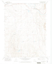
1971 Map of Mount Harris
USGS Topo · Published 1974About this map
The Yampa River valley in the early 1970s reveals a landscape transitioning between agricultural roots and industrial expansion. West of the Denver and Rio Grande Western railroad, the town of Hayden is anchored by its local Cem and proximity to the Yampa Valley Airport. The terrain to the south rises toward Hillberry Mountain, where the land is carved by Sage Creek Canyon and Sage Creek.
Find a feature on this map
32 named features on this map. Tap any name to fly to it.
Don’t see what you’re looking for? This feature index may not catch every label — zoom into the map to look around manually.
Map Details
Editions of this 1971 Mount Harris Map
This is the sole edition of this map. No revisions or reprints were ever made.
Other maps of this area

1916 · Daton Peak
USGS Topo · 1:62,500

1920 · Daton Peak
USGS Topo · 1:62,500

1923 · Elkhead Creek
USGS Topo · 1:62,500

1923 · Pilot Knob
USGS Topo · 1:62,500

1924 · Elkhead Creek
USGS Topo · 1:62,500

1924 · Mt. Harris
USGS Topo · 1:48,000

1925 · Pilot Knob
USGS Topo · 1:62,500

1926 · Mount Harris
USGS Topo · 1:62,500

1954 · Craig
USGS Topo · 1:250,000

1957 · Craig
USGS Topo · 1:250,000