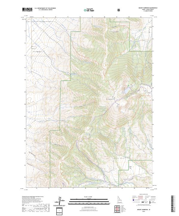
2023 Map of Mount Harrison
USGS Topo · Published 2023About this map
The Albion Mountains define the character of this high-elevation landscape within the Sawtooth National Forest. Rising toward the prominent peak of Mt Harrison, the terrain is marked by a complex network of drainage basins including Boulder Canyon, Big Cedar Canyon, and Little Cedar Canyon. These steep canyons feed numerous watercourses such as Robinson Creek and Willow Creek that flow through the surrounding flats and hollows.
Find a feature on this map
40 named features on this map. Tap any name to fly to it.
Don’t see what you’re looking for? This feature index may not catch every label — zoom into the map to look around manually.
Map Details
Editions of this 2023 Mount Harrison Map
This is the sole edition of this map. No revisions or reprints were ever made.
Other maps of this area

1954 · Pocatello
USGS Topo · 1:250,000

1958 · Pocatello
USGS Topo · 1:250,000

1964 · View
USGS Topo · 1:24,000

1964 · Kenyon
USGS Topo · 1:24,000

1968 · Cache Peak
USGS Topo · 1:24,000

1968 · Basin
USGS Topo · 1:24,000

1968 · Marion SE
USGS Topo · 1:24,000

1968 · Elba
USGS Topo · 1:24,000

1968 · Mount Harrison
USGS Topo · 1:24,000

1968 · Albion
USGS Topo · 1:24,000