
1968 Map of Albion
USGS Topo · Published 1972About this map
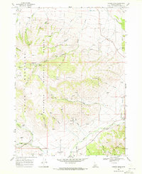
Albion occupies a central valley position between the Albion Mountains to the southwest and the East Hills to the northeast. This 1968 survey details a landscape defined by its vital water sources, with numerous springs such as Bridger Spring and Water Canyon Spring feeding the drainage systems of Howell Creek and Marsh Creek. The town is supported by a network of wells and infrastructure including a Radio Facility and a Gaging Station. Cultural markers of the area's history are evident at the Cem and Pleasant Hill, while the surrounding terrain is etched with prospects and several gravel pits, indicating local extraction industries. The transition from the flat agricultural valley to the steep canyons of White Pine Canyon and Harroun Canyon illustrates the geographical constraints that shaped the development of this Idaho settlement.
Find a feature on this map
27 named features on this map. Tap any name to fly to it.
Don’t see what you’re looking for? This feature index may not catch every label — zoom into the map to look around manually.
Map Details
Editions of this 1968 Albion Map
This is the sole edition of this map. No revisions or reprints were ever made.
Other maps of this area

1954 · Pocatello
USGS Topo · 1:250,000

1958 · Pocatello
USGS Topo · 1:250,000

1959 · Lake Walcott
USGS Topo · 1:62,500

1964 · Rupert SE
USGS Topo · 1:24,000

1964 · View
USGS Topo · 1:24,000

1964 · Rupert SW
USGS Topo · 1:24,000

1968 · Idahome
USGS Topo · 1:24,000

1968 · Mount Harrison
USGS Topo · 1:24,000

1968 · Nibbs Creek
USGS Topo · 1:24,000
1968 · Connor Ridge
USGS Topo · 1:24,000