
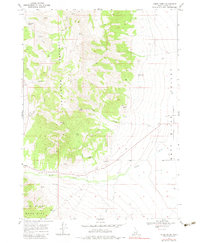
1968 Map of Nibbs Creek
USGS Topo · Published 1972About this map
The Cotterel Mountains and the Jim Sage Mountains frame a dramatic high-desert landscape where the Raft River Valley meets rugged upland drainage. This 1968 field-checked survey highlights the crucial role of water in the region, documenting numerous vital sources such as Nibbs Spring, Rice Spring, and McClendon Spring that sustain life in the arid Idaho terrain.
Find a feature on this map
25 named features on this map. Tap any name to fly to it.
Don’t see what you’re looking for? This feature index may not catch every label — zoom into the map to look around manually.
Map Details
Editions of this 1968 Nibbs Creek Map
2 editions found
Other maps of this area

1954 · Pocatello
USGS Topo · 1:250,000

1958 · Pocatello
USGS Topo · 1:250,000

1968 · Malta NE
USGS Topo · 1:24,000

1968 · Malta
USGS Topo · 1:24,000

1968 · Idahome
USGS Topo · 1:24,000

1968 · Elba
USGS Topo · 1:24,000

1968 · Kane Canyon
USGS Topo · 1:24,000

1968 · Albion
USGS Topo · 1:24,000
1968 · Connor Ridge
USGS Topo · 1:24,000

1968 · Bridge
USGS Topo · 1:24,000