
1968 Map of Kane Canyon
USGS Topo · Published 1972About this map
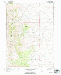
The Jim Sage Mountains dominate this 1960s landscape, rising sharply above the Raft River Valley in southern Cassia County. This era of land use is defined by water management and mineral exploration, evidenced by the numerous named water sources such as Red Rock Spring and Kane Springs that sustain life in the arid high-country. A lonely Prospect near Red Rock Mountain points to the area's history of small-scale mining efforts, while a network of Jeep Trails provides the primary access through the steep terrain between Sheep Mountain and Cedar Knoll. The transition from the high peaks down to the Raft River drainage, including the winding course of Cottonwood Creek, illustrates the essential relationship between the upland topography and the valley floor.
Find a feature on this map
16 named features on this map. Tap any name to fly to it.
Don’t see what you’re looking for? This feature index may not catch every label — zoom into the map to look around manually.
Map Details
Editions of this 1968 Kane Canyon Map
2 editions found
Other maps of this area

1954 · Pocatello
USGS Topo · 1:250,000

1958 · Pocatello
USGS Topo · 1:250,000

1968 · Malta
USGS Topo · 1:24,000

1968 · Jim Sage Canyon
USGS Topo · 1:24,000

1968 · Elba
USGS Topo · 1:24,000

1968 · Nibbs Creek
USGS Topo · 1:24,000

1968 · Naf
USGS Topo · 1:24,000

1968 · Chokecherry Canyon
USGS Topo · 1:24,000
1968 · Connor Ridge
USGS Topo · 1:24,000

1968 · Bridge
USGS Topo · 1:24,000