
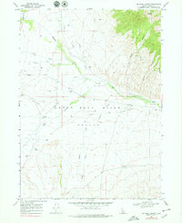
1968 Map of Jim Sage Canyon
USGS Topo · Published 1972About this map
California Trail and Salt Lake Alternate routes cut through this landscape, marking the historic movement of pioneers across the Upper Raft River Valley. The terrain is defined by a series of drainages, including Almo Creek and Edwards Creek, that flow toward the Raft River as it passes through the constricted passage of The Narrows. To the north, the elevation rises sharply into Jim Sage Canyon, where water sources like Jim Sage Spring provided critical relief in an arid environment. This 1968 survey details a network of water-management features, including numerous unnamed wells and a series of Borrow Pits, illustrating the ranching and infrastructure needs of southern Cassia County during the mid-20th century. The presence of a Jeep Trail winding through the canyons suggests the continuing utility of these remote corridors long after the era of the wagon trains.
Find a feature on this map
21 named features on this map. Tap any name to fly to it.
Don’t see what you’re looking for? This feature index may not catch every label — zoom into the map to look around manually.
Map Details
Editions of this 1968 Jim Sage Canyon Map
2 editions found
Other maps of this area

1954 · Pocatello
USGS Topo · 1:250,000

1954 · Brigham City
USGS Topo · 1:250,000

1958 · Pocatello
USGS Topo · 1:250,000

1958 · Brigham City
USGS Topo · 1:250,000

1959 · Park Valley
USGS Topo · 1:62,500

1959 · Yost
USGS Topo · 1:62,500

1962 · Brigham City
USGS Topo · 1:250,000

1968 · Almo
USGS Topo · 1:24,000

1968 · Cache Peak
USGS Topo · 1:24,000

1968 · Elba
USGS Topo · 1:24,000