
1968 Map of Almo
USGS Topo · Published 1972About this map
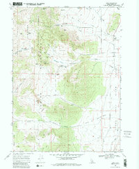
The striking granite formations of the City of Rocks dominate this late 1960s survey of southern Idaho. This high-altitude landscape is defined by the Albion Mountains and the Cedar Hills, where landmark monoliths like Bath Rock, Treasure Rock, and the Twin Sisters provided critical navigation points for travelers. The settlement of Almo sits in the valley to the east, positioned near the junction of mountain streams and the Raft River Valley.
Find a feature on this map
47 named features on this map. Tap any name to fly to it.
Don’t see what you’re looking for? This feature index may not catch every label — zoom into the map to look around manually.
Map Details
Editions of this 1968 Almo Map
3 editions found
Other maps of this area

1954 · Pocatello
USGS Topo · 1:250,000

1954 · Brigham City
USGS Topo · 1:250,000

1958 · Pocatello
USGS Topo · 1:250,000

1958 · Brigham City
USGS Topo · 1:250,000

1959 · Cotton Thomas Basin
USGS Topo · 1:62,500

1959 · Yost
USGS Topo · 1:62,500

1962 · Brigham City
USGS Topo · 1:250,000

1968 · Cache Peak
USGS Topo · 1:24,000

1968 · Basin
USGS Topo · 1:24,000

1968 · Jim Sage Canyon
USGS Topo · 1:24,000