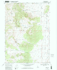
1968 Map of Almo
USGS Topo · Published 1979About this map
The City of Rocks dominates this portion of southern Idaho, where massive granite formations emerge from the high desert landscape. The settlement of Almo serves as the gateway to this geological corridor, situated near the confluence of Almo Creek and Edwards Creek. The map documents a critical crossroads of western migration, showing the convergence of the California Trail (Applegate) and the California Trail (Salt Lake Alternate). These historic paths wind through Emigrant Canyon and past distinctive landmarks like Register Rock and Treasure Rock, where 19th-century travelers carved their names into the stone.
Find a feature on this map
50 named features on this map. Tap any name to fly to it.
Don’t see what you’re looking for? This feature index may not catch every label — zoom into the map to look around manually.
Map Details
Editions of this 1968 Almo Map
3 editions found
Other maps of this area

1954 · Pocatello
USGS Topo · 1:250,000

1954 · Brigham City
USGS Topo · 1:250,000

1958 · Pocatello
USGS Topo · 1:250,000

1958 · Brigham City
USGS Topo · 1:250,000

1959 · Cotton Thomas Basin
USGS Topo · 1:62,500

1959 · Yost
USGS Topo · 1:62,500

1962 · Brigham City
USGS Topo · 1:250,000

1968 · Almo
USGS Topo · 1:24,000

1968 · Cache Peak
USGS Topo · 1:24,000

1968 · Basin
USGS Topo · 1:24,000