
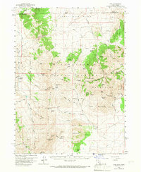
1959 Map of Yost
USGS Topo · Published 1960About this map
The Upper Raft River Valley defines the northern reaches of this 1959 survey, where the Idaho-Utah state line bisects the high desert and mountain terrain. Small agricultural settlements like Yost and Lynn anchor the landscape, connected by the Junction Road and various mountain trails. The presence of the Junction School and the Yost Cemetery provides specific points of interest for genealogists tracing families in this corner of Box Elder County.
Find a feature on this map
85 named features on this map. Tap any name to fly to it.
Don’t see what you’re looking for? This feature index may not catch every label — zoom into the map to look around manually.
Map Details
Editions of this 1959 Yost Map
2 editions found
Other maps of this area

1954 · Pocatello
USGS Topo · 1:250,000

1954 · Brigham City
USGS Topo · 1:250,000

1958 · Pocatello
USGS Topo · 1:250,000

1958 · Brigham City
USGS Topo · 1:250,000

1959 · Cotton Thomas Basin
USGS Topo · 1:62,500

1959 · Park Valley
USGS Topo · 1:62,500

1962 · Brigham City
USGS Topo · 1:250,000

1968 · Almo
USGS Topo · 1:24,000

1968 · Jim Sage Canyon
USGS Topo · 1:24,000

1968 · Lyman Pass
USGS Topo · 1:24,000