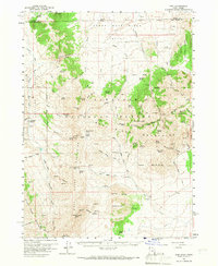
1959 Map of Yost
USGS Topo · Published 1967About this map
The Upper Raft River Valley serves as a geographic centerpiece for this 1959 field survey of the Utah-Idaho borderlands. Settled life centers around the small communities of Yost and Lynn, which are connected by a network of unimproved roads and jeep trails navigating the high-altitude terrain. The presence of the Junction School and the Yost Cemetery marks the social and ancestral centers for the ranching families who worked these isolated valleys before modern infrastructure arrived. To the south, the Raft River Mountains dominate the landscape, with landmarks like Mahogany Peaks and Marble Canyon Peak rising above the timberline.
Find a feature on this map
89 named features on this map. Tap any name to fly to it.
Don’t see what you’re looking for? This feature index may not catch every label — zoom into the map to look around manually.
Map Details
Editions of this 1959 Yost Map
2 editions found
Other maps of this area

1954 · Pocatello
USGS Topo · 1:250,000

1954 · Brigham City
USGS Topo · 1:250,000

1958 · Pocatello
USGS Topo · 1:250,000

1958 · Brigham City
USGS Topo · 1:250,000

1959 · Cotton Thomas Basin
USGS Topo · 1:62,500

1959 · Park Valley
USGS Topo · 1:62,500

1959 · Yost
USGS Topo · 1:62,500

1962 · Brigham City
USGS Topo · 1:250,000

1968 · Almo
USGS Topo · 1:24,000

1968 · Jim Sage Canyon
USGS Topo · 1:24,000