
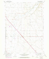
1968 Map of Malta NE
USGS Topo · Published 1972About this map
Raft River Valley opens across this Idaho landscape in the late 1960s, defined by its water systems and the infrastructure of the high desert. The Raft River itself meanders through the central basin, joined by Warm Creek as it flows through a region largely dedicated to ranching and utility transport. Evidence of mid-century industrial growth is visible in the network of pipelines crossing the valley floor and the presence of a Substation near the southern boundary. The landscape is marked by numerous extraction sites, including various Borrow Pits and a Gravel Pit, which supported the development of local thoroughfares like the Idaho Road. This survey documents a transition in the rural West where traditional water-dependent agriculture met the rising demands of energy infrastructure and modernized transport.
Find a feature on this map
9 named features on this map. Tap any name to fly to it.
Don’t see what you’re looking for? This feature index may not catch every label — zoom into the map to look around manually.
Map Details
Editions of this 1968 Malta NE Map
2 editions found
Other maps of this area

1954 · Pocatello
USGS Topo · 1:250,000

1958 · Pocatello
USGS Topo · 1:250,000

1958 · Sublett
USGS Topo · 1:62,500

1959 · Lake Walcott
USGS Topo · 1:62,500

1959 · Yale
USGS Topo · 1:62,500

1968 · Malta
USGS Topo · 1:24,000

1968 · Idahome
USGS Topo · 1:24,000

1968 · Nibbs Creek
USGS Topo · 1:24,000

1984 · North Chapin Mountain
USGS Topo · 1:24,000
1984 · Lake Walcott SE
USGS Topo · 1:24,000