
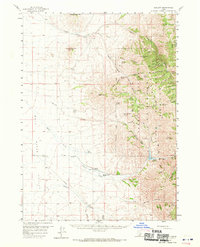
1958 Map of Sublett
USGS Topo · Published 1960About this map
Sawtooth National Forest dominates the eastern high ground of this Idaho quadrangle, where a complex network of canyons and springs defines the late 1950s landscape. From North Heglar Canyon to the Van Camp Trail, the map details a wilderness where water sources are vital, documented by numerous named features such as Bruce Young Spring, Moonshine Spring, and Indian Spring. These labels provide essential data for local historians tracing early land use and backcountry movement.
Find a feature on this map
56 named features on this map. Tap any name to fly to it.
Don’t see what you’re looking for? This feature index may not catch every label — zoom into the map to look around manually.
Map Details
Editions of this 1958 Sublett Map
2 editions found
Other maps of this area

1934 · Rockland
USGS Topo · 1:62,500

1937 · Rockland
USGS Topo · 1:62,500

1954 · Pocatello
USGS Topo · 1:250,000

1958 · Pocatello
USGS Topo · 1:250,000

1959 · Strevell
USGS Topo · 1:62,500

1959 · Lake Walcott
USGS Topo · 1:62,500

1959 · Yale
USGS Topo · 1:62,500

1968 · Malta NE
USGS Topo · 1:24,000

1968 · Malta
USGS Topo · 1:24,000

1968 · Bridge
USGS Topo · 1:24,000