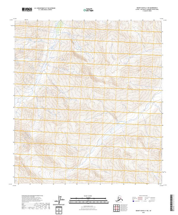
2024 Map of Mount Hayes A-1 NE
USGS Topo · Published 2024About this map
Tok Glacier dominates the southwestern corner of this landscape, its presence shaping the high alpine environment of the Mount Hayes A-1 NE region. The glacial melt feeds into the Tok River, which winds its way through the southern half of the terrain, while Rumble Creek flows through the northwestern elevations. This 2024 map documents a largely unpopulated area defined by steep contour intervals and significant elevation changes. The land is organized by the Public Land Survey System grids of t17n r6e, t17n r7e, t16n r6e, and t16n r7e, illustrating the vast, undeveloped character of the Alaska interior in the modern era.
Find a feature on this map
7 named features on this map. Tap any name to fly to it.
Don’t see what you’re looking for? This feature index may not catch every label — zoom into the map to look around manually.
Map Details
Editions of this 2024 Mount Hayes A-1 NE Map
This is the sole edition of this map. No revisions or reprints were ever made.
Other maps of this area

1948 · Tanacross A-6
USGS Topo · 1:63,360

1949 · Tanacross
USGS Topo · 1:250,000

1949 · Tanacross B-6
USGS Topo · 1:63,360

1949 · Mt. Hayes A-1
USGS Topo · 1:63,360

1950 · Tanacross
USGS Topo · 1:250,000

1950 · Mount Hayes
USGS Topo · 1:250,000

1951 · Mount Hayes
USGS Topo · 1:250,000

1951 · Tanacross B-6
USGS Topo · 1:63,360
1952 · Tanacross A-6
USGS Topo · 1:63,360

1954 · Mount Hayes B-1
USGS Topo · 1:63,360