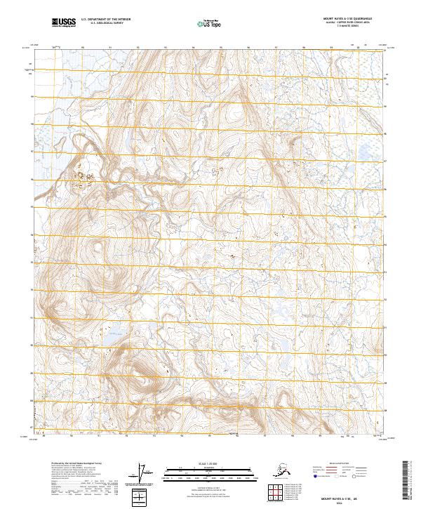
2024 Map of Mount Hayes A-3 SE
USGS Topo · Published 2024About this map
The Gakona River carves through the northwestern edge of this interior landscape, marking a significant drainage path within the Copper River Census Area. This terrain is characterized by high-elevation water bodies, most notably the centrally located Caribou Lake and the smaller Alder Lake to its north. These lakes suggest a high-plateau environment where glacial or permafrost-driven hydrology dominates the drainage patterns. Toward the southeastern corner, the flow of Sinona Creek and Excelsior Creek indicates the localized watershed divisions that define this part of the Alaska Range's southern foothills. The map provides a detailed view of the Public Land Survey System divisions, including t21s r13e and t21s r14e, which are essential for understanding land partitioning and property boundaries in this wilderness region.
Find a feature on this map
9 named features on this map. Tap any name to fly to it.
Don’t see what you’re looking for? This feature index may not catch every label — zoom into the map to look around manually.
Map Details
Editions of this 2024 Mount Hayes A-3 SE Map
This is the sole edition of this map. No revisions or reprints were ever made.
Other maps of this area

1949 · Gulkana D-3
USGS Topo · 1:63,360

1950 · Mount Hayes
USGS Topo · 1:250,000

1950 · Mount Hayes A-3
USGS Topo · 1:63,360

1951 · Gulkana
USGS Topo · 1:250,000

1951 · Mount Hayes
USGS Topo · 1:250,000

1952 · Gulkana D-3
USGS Topo · 1:63,360

1952 · Mount Hayes A-3
USGS Topo · 1:63,360
1954 · Gulkana D-2
USGS Topo · 1:63,360
1954 · Gulkana D-3
USGS Topo · 1:63,360
1954 · Mount Hayes A-3
USGS Topo · 1:63,360