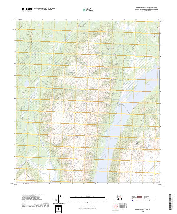
2024 Map of Mount Hayes C-2 NW
USGS Topo · Published 2024About this map
Deltana stands at the northwestern edge of this interior landscape, where the braided channels of the Johnson River dominate the eastern drainage. This modern survey illustrates a rugged transition from the lowlands into the rising elevations of Independent Ridge, a prominent landform that separates the primary river valley from western tributaries. The hydrological pattern is defined by glacial and snowmelt systems, including the Little Gerstle River and several smaller waterways like Sheep Creek and Bernadette Creek. These streams flow through a complex terrain of wetlands and topographic breaks, while South Johnson Lake and the aptly named Dry Creek sit tucked within the eastern valley floor. The map provides a detailed view of the natural corridors and land divisions in this part of the Southeast Fairbanks Census Area, documenting the region's geography and water systems.
Find a feature on this map
14 named features on this map. Tap any name to fly to it.
Don’t see what you’re looking for? This feature index may not catch every label — zoom into the map to look around manually.
Map Details
Editions of this 2024 Mount Hayes C-2 NW Map
This is the sole edition of this map. No revisions or reprints were ever made.
Other maps of this area

1950 · Mount Hayes
USGS Topo · 1:250,000

1951 · Mount Hayes
USGS Topo · 1:250,000

1954 · Mount Hayes C-3
USGS Topo · 1:63,360

1954 · Mount Hayes D-2
USGS Topo · 1:63,360

1954 · Mount Hayes D-3
USGS Topo · 1:63,360

1955 · Mount Hayes C-2
USGS Topo · 1:63,360

1955 · Mount Hayes D-2
USGS Topo · 1:63,360
1955 · Mount Hayes D-3
USGS Topo · 1:63,360

1955 · Mount Hayes C-3
USGS Topo · 1:63,360

1955 · Mount Hayes
USGS Topo · 1:250,000