
1955 Map of Mount Hayes C-2
USGS Topo · Published 1958About this map
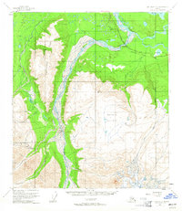
The braided channels of the Johnson River dominate this interior Alaskan landscape, illustrating the dynamic hydrology of the region as it cuts through the Tanana River valley. Along the northern edge, the corridor for the Alaska Highway is established, accompanied by logistical infrastructure including a Bureau of Public Roads Camp and an aboveground pipeline. These features reflect the mid-century development of the Alaskan wilderness for transportation and resource transit. The terrain rises sharply from the river flats to high-altitude features like Independent Ridge and the expansive Macomb Plateau. Waterways such as Pegmatite Creek and Prospect Creek drain these uplands, while Moosehead Lake sits in the northeast corner. The map provides a detailed view of the interaction between natural barriers and the thin line of human engineering during the territorial era.
Find a feature on this map
19 named features on this map. Tap any name to fly to it.
Don’t see what you’re looking for? This feature index may not catch every label — zoom into the map to look around manually.
Map Details
Editions of this 1955 Mount Hayes C-2 Map
4 editions found
Other maps of this area

1950 · Mount Hayes
USGS Topo · 1:250,000

1951 · Mount Hayes
USGS Topo · 1:250,000

1954 · Mount Hayes B-1
USGS Topo · 1:63,360

1954 · Mount Hayes C-3
USGS Topo · 1:63,360

1954 · Mount Hayes D-2
USGS Topo · 1:63,360

1954 · Mount Hayes D-3
USGS Topo · 1:63,360

1954 · Mount Hayes D-1
USGS Topo · 1:63,360

1954 · Mount Hayes C-1
USGS Topo · 1:63,360

1955 · Mount Hayes B-3
USGS Topo · 1:63,360

1955 · Mount Hayes B-2
USGS Topo · 1:63,360