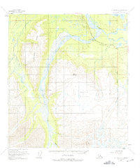
1955 Map of Mount Hayes C-2
USGS Topo · Published 1975About this map
The Tanana River and its complex network of braided channels dominate this mid-century Alaskan interior landscape. During this era of post-war infrastructure development, the Alaska Highway runs along the northern bank of the river, accompanied by an Aboveground Pipeline and a Telephone Line, reflecting the essential utility corridors of the territory. The map reveals a vital Highway Maintenance Station positioned near the confluence of the river and Johnson Slough, a critical support point for travelers in this demanding environment.
Find a feature on this map
23 named features on this map. Tap any name to fly to it.
Don’t see what you’re looking for? This feature index may not catch every label — zoom into the map to look around manually.
Map Details
Editions of this 1955 Mount Hayes C-2 Map
4 editions found
Other maps of this area

1950 · Mount Hayes
USGS Topo · 1:250,000

1951 · Mount Hayes
USGS Topo · 1:250,000

1954 · Mount Hayes B-1
USGS Topo · 1:63,360

1954 · Mount Hayes C-3
USGS Topo · 1:63,360

1954 · Mount Hayes D-2
USGS Topo · 1:63,360

1954 · Mount Hayes D-3
USGS Topo · 1:63,360

1954 · Mount Hayes D-1
USGS Topo · 1:63,360

1954 · Mount Hayes C-1
USGS Topo · 1:63,360

1955 · Mount Hayes B-3
USGS Topo · 1:63,360

1955 · Mount Hayes C-2
USGS Topo · 1:63,360