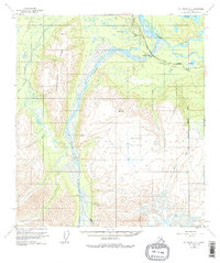
1955 Map of Mount Hayes C-2
USGS Topo · Published 1975About this map
The Johnson River dominates this mid-century Alaskan landscape, its braided channels and gravel bars carving a wide path through the interior. Parallel to the Tanana River in the northeast, the Alaska Highway serves as the primary artery for transportation, accompanied by a Pipeline and Telephone Line that underscore the era's infrastructure development. A Highway Maintenance Station and a Gaging Sta near Johnson Slough mark the sparse human footprint in this wilderness.
Find a feature on this map
24 named features on this map. Tap any name to fly to it.
Don’t see what you’re looking for? This feature index may not catch every label — zoom into the map to look around manually.
Map Details
Editions of this 1955 Mount Hayes C-2 Map
4 editions found
Other maps of this area

1950 · Mount Hayes
USGS Topo · 1:250,000

1951 · Mount Hayes
USGS Topo · 1:250,000

1954 · Mount Hayes B-1
USGS Topo · 1:63,360

1954 · Mount Hayes C-3
USGS Topo · 1:63,360

1954 · Mount Hayes D-2
USGS Topo · 1:63,360

1954 · Mount Hayes D-3
USGS Topo · 1:63,360

1954 · Mount Hayes D-1
USGS Topo · 1:63,360

1954 · Mount Hayes C-1
USGS Topo · 1:63,360

1955 · Mount Hayes B-3
USGS Topo · 1:63,360

1955 · Mount Hayes C-2
USGS Topo · 1:63,360