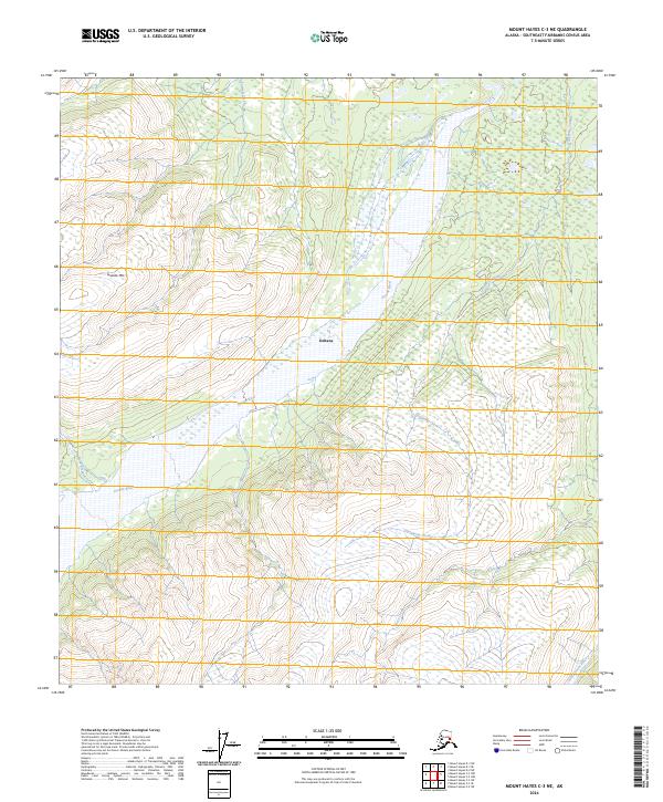
2024 Map of Mount Hayes C-3 NE
USGS Topo · Published 2024About this map
Gerstle River dominates this interior Alaskan landscape, its braided channels cutting through the terrain of the Southeast Fairbanks Census Area. The settlement of Deltana appears near the central portion of the sheet, situated within a vast network of watercourses and topographical extremes. To the west, the elevation rises sharply toward Granite Mtn, a prominent landmark overlooking the surrounding drainage basins. This 2024 survey captures the intricate hydrography of the region, where numerous tributaries such as Sawmill Creek and Dougherty Creek feed into the larger river systems. The southeastern corner is defined by the Little Gerstle River, while smaller flows like Sheep Creek and Bedford Creek traverse the alluvial fans and complex slopes of the northern Tanana Valley region.
Find a feature on this map
14 named features on this map. Tap any name to fly to it.
Don’t see what you’re looking for? This feature index may not catch every label — zoom into the map to look around manually.
Map Details
Editions of this 2024 Mount Hayes C-3 NE Map
This is the sole edition of this map. No revisions or reprints were ever made.
Other maps of this area

1950 · Mount Hayes
USGS Topo · 1:250,000

1951 · Mount Hayes
USGS Topo · 1:250,000

1954 · Mount Hayes C-3
USGS Topo · 1:63,360

1954 · Mount Hayes D-2
USGS Topo · 1:63,360

1954 · Mount Hayes D-3
USGS Topo · 1:63,360

1955 · Mount Hayes C-2
USGS Topo · 1:63,360

1955 · Mount Hayes D-2
USGS Topo · 1:63,360
1955 · Mount Hayes D-3
USGS Topo · 1:63,360

1955 · Mount Hayes C-3
USGS Topo · 1:63,360

1955 · Mount Hayes
USGS Topo · 1:250,000