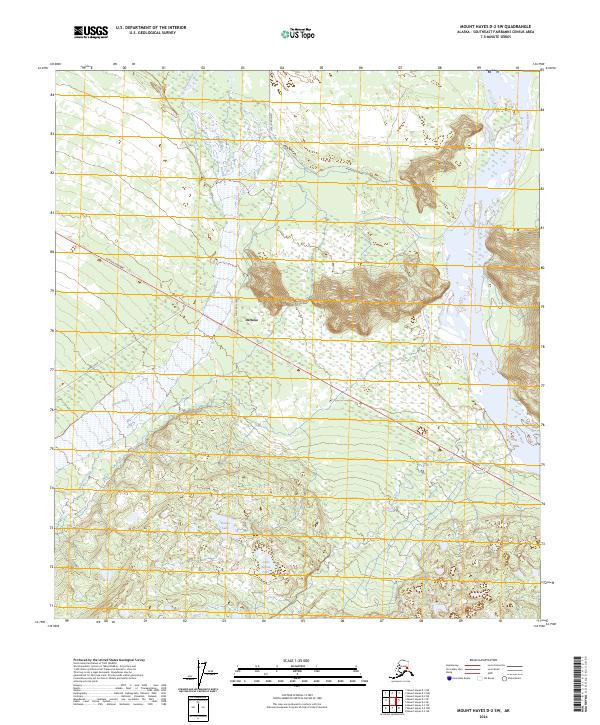
2024 Map of Mount Hayes D-2 SW
USGS Topo · Published 2024About this map
Deltana serves as a central hub in this Southeast Fairbanks landscape, situated near the braided channels of the Gerstle River. The settlement is connected by the Alaska Highway, which cuts diagonally across the terrain, and a network of local routes including Cummings Street and Tower Road. To the northeast, the massive Tanana River corridor dominates the topography, while the smaller Little Gerstle River winds through the wetlands and forests to the south. Further into the interior, recreation and natural drainage patterns are defined by Donna Lake, Little Donna Lake, and the winding Dougherty Creek. The map illustrates the characteristic Alaskan interior development pattern where modern infrastructure follows natural river valleys and ancient glacial outwash plains, providing essential access to remote water bodies and residential pockets.
Find a feature on this map
15 named features on this map. Tap any name to fly to it.
Don’t see what you’re looking for? This feature index may not catch every label — zoom into the map to look around manually.
Map Details
Editions of this 2024 Mount Hayes D-2 SW Map
This is the sole edition of this map. No revisions or reprints were ever made.
Other maps of this area

1950 · Mount Hayes
USGS Topo · 1:250,000

1951 · Mount Hayes
USGS Topo · 1:250,000

1954 · Mount Hayes C-3
USGS Topo · 1:63,360

1954 · Mount Hayes D-2
USGS Topo · 1:63,360

1954 · Mount Hayes D-3
USGS Topo · 1:63,360

1955 · Mount Hayes C-2
USGS Topo · 1:63,360

1955 · Mount Hayes D-2
USGS Topo · 1:63,360
1955 · Mount Hayes D-3
USGS Topo · 1:63,360

1955 · Mount Hayes C-3
USGS Topo · 1:63,360

1955 · Mount Hayes
USGS Topo · 1:250,000