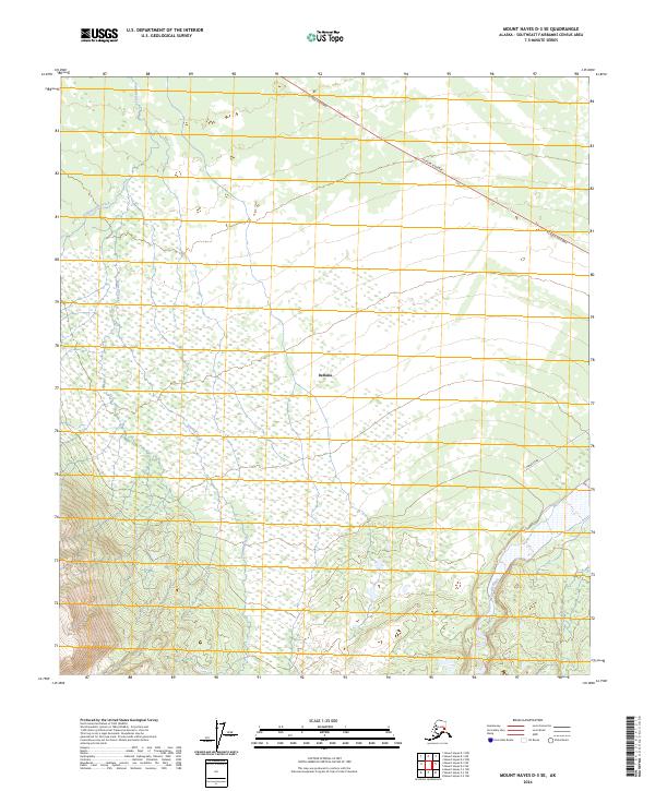
2024 Map of Mount Hayes D-3 SE
USGS Topo · Published 2024About this map
The settlement of Deltana serves as a central point in this Interior Alaska landscape, situated where the lowlands meet the rising elevations of the eastern Alaska Range. The Alaska Highway cuts across the northern reaches, a vital transportation artery that has shaped the development of Southeast Fairbanks for decades. To the east, the braided channels of the Gerstle River dominate the topography, illustrating the dynamic glacial runoff patterns common to this region.
Find a feature on this map
11 named features on this map. Tap any name to fly to it.
Don’t see what you’re looking for? This feature index may not catch every label — zoom into the map to look around manually.
Map Details
Editions of this 2024 Mount Hayes D-3 SE Map
This is the sole edition of this map. No revisions or reprints were ever made.
Other maps of this area

1950 · Mount Hayes
USGS Topo · 1:250,000

1951 · Mount Hayes
USGS Topo · 1:250,000

1954 · Mount Hayes C-3
USGS Topo · 1:63,360

1954 · Mount Hayes D-2
USGS Topo · 1:63,360

1954 · Mount Hayes D-3
USGS Topo · 1:63,360

1955 · Mount Hayes C-2
USGS Topo · 1:63,360

1955 · Mount Hayes D-2
USGS Topo · 1:63,360
1955 · Mount Hayes D-3
USGS Topo · 1:63,360

1955 · Mount Hayes C-3
USGS Topo · 1:63,360

1955 · Mount Hayes
USGS Topo · 1:250,000