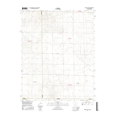
2016 Map of Mount Helen
USGS Topo · Published 2016About this map
Mount Helen rises above the high plains terrain along the state line where the Oklahoma Panhandle meets Kansas. This 2016 survey documents a rural landscape defined by section-line roads and ephemeral watercourses. In the southeastern portion of the quadrangle, Wells Reservoir provides a critical water source in an otherwise arid drainage basin. The map illustrates a complex convergence of county lines, including Meade, Clark, and Beaver counties. Local transit is facilitated by a network of rural routes such as AA Rd, CR BB, and EE Rd, which navigate the draws formed by Fivemile Cr, Twomile Cr, and Big Sandy Cr. The geography here reflects the persistence of the Public Land Survey System, with township and range divisions like t34s r25w and t35s r26w dictating the grid of the modern prairie.
Find a feature on this map
23 named features on this map. Tap any name to fly to it.
Don’t see what you’re looking for? This feature index may not catch every label — zoom into the map to look around manually.
Map Details
Editions of this 2016 Mount Helen Map
This is the sole edition of this map. No revisions or reprints were ever made.
Other maps of this area

1892 · Meade
USGS Topo · 1:125,000

1896 · Ashland
USGS Topo · 1:125,000

1954 · Perryton
USGS Topo · 1:250,000

1955 · Woodward
USGS Topo · 1:250,000

1955 · Pratt
USGS Topo · 1:250,000

1955 · Dodge City
USGS Topo · 1:250,000

1958 · Perryton
USGS Topo · 1:250,000

1958 · Woodward
USGS Topo · 1:250,000

1958 · Dodge City
USGS Topo · 1:250,000

1959 · Pratt
USGS Topo · 1:250,000