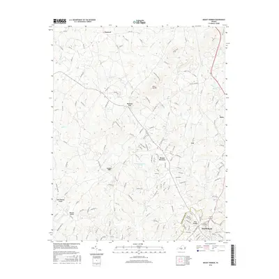
2016 Map of Mount Hermon
USGS Topo · Published 2016About this map
Mount Hermon and its surrounding Pittsylvania County landscapes are defined by a network of creeks and small settlements transitioning into the northern edge of Danville. The terrain is shaped by the presence of White Oak Mtn to the north, which overlooks several small communities like Pleasant Gap and Hopewell. The map illustrates a developed rural-to-suburban landscape where legacy sites like Laniers Mill and Mount Cross sit alongside modern residential growth. Transportation is anchored by the Norfolk Southern rail line passing through Witt and Blairs on the eastern edge of the quadrangle. Significant water bodies such as Tuscarora Country Club Lake and Deer Wood Springs Lake provide local landmarks among the drainages of White Oak Cr and Fall Cr. For those tracing local genealogy or land use, the map details established sites like Highland Burial Park and the distinct neighborhoods of New Design and New Mount Cross.
Find a feature on this map
150 named features on this map. Tap any name to fly to it.
Don’t see what you’re looking for? This feature index may not catch every label — zoom into the map to look around manually.
Map Details
Editions of this 2016 Mount Hermon Map
This is the sole edition of this map. No revisions or reprints were ever made.
Other maps of this area

1921 · Chatham
USGS Topo · 1:48,000

1922 · Callands
USGS Topo · 1:48,000

1923 · Danville
USGS Topo · 1:48,000

1923 · Chatham
USGS Topo · 1:62,500

1924 · Draper
USGS Topo · 1:48,000

1924 · Callands
USGS Topo · 1:62,500

1925 · Danville
USGS Topo · 1:62,500

1926 · Draper
USGS Topo · 1:62,500

1944 · Draper
USGS Topo · 1:62,500

1944 · Callands
USGS Topo · 1:62,500