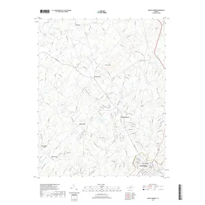
2019 Map of Mount Hermon
USGS Topo · Published 2019About this map
White Oak Mtn rises as a prominent landmark in this section of Pittsylvania County, overlooking a landscape defined by the upper reaches of Sandy Creek and Fall Creek. The area north of Danville shows a network of established settlements such as Mount Hermon, Pleasant Gap, and Witt, connected by a web of local routes like Franklin Turnpike and Tobacco Road. This 2019 survey documents the transition from the denser residential developments of New Design and the Highland Burial Park near the city line to the more dispersed communities further north.
Find a feature on this map
156 named features on this map. Tap any name to fly to it.
Don’t see what you’re looking for? This feature index may not catch every label — zoom into the map to look around manually.
Map Details
Editions of this 2019 Mount Hermon Map
This is the sole edition of this map. No revisions or reprints were ever made.
Other maps of this area

1921 · Chatham
USGS Topo · 1:48,000

1922 · Callands
USGS Topo · 1:48,000

1923 · Danville
USGS Topo · 1:48,000

1923 · Chatham
USGS Topo · 1:62,500

1924 · Draper
USGS Topo · 1:48,000

1924 · Callands
USGS Topo · 1:62,500

1925 · Danville
USGS Topo · 1:62,500

1926 · Draper
USGS Topo · 1:62,500

1944 · Draper
USGS Topo · 1:62,500

1944 · Callands
USGS Topo · 1:62,500