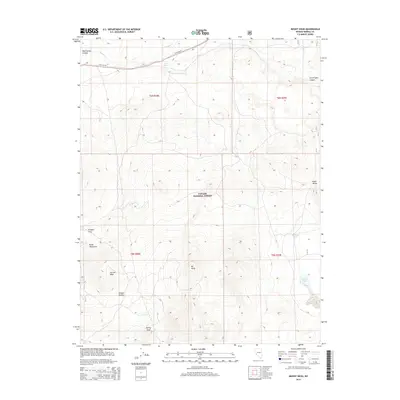
2014 Map of Mount Hicks
USGS Topo · Published 2014About this map
Mt Hicks rises as a central landmark in this high-desert portion of the Toiyabe National Forest within Mineral County. The terrain is defined by dramatic elevation changes, featuring prominent heights like Aurora Peak and Spring Peak alongside the sprawling Bodie Mountains. Water sources are sparse but critical to the landscape, marked by names like Mud Spring and the Squaw Cr drainage to the north.
Find a feature on this map
19 named features on this map. Tap any name to fly to it.
Don’t see what you’re looking for? This feature index may not catch every label — zoom into the map to look around manually.
Map Details
Editions of this 2014 Mount Hicks Map
This is the sole edition of this map. No revisions or reprints were ever made.
Other maps of this area

1909 · Hawthorne
USGS Topo · 1:250,000

1911 · Hawthorne
USGS Topo · 1:250,000

1915 · Hawthorne
USGS Topo · 1:250,000

1948 · Walker Lake
USGS Topo · 1:250,000

1955 · Powell Mtn
USGS Topo · 1:62,500

1956 · Aurora
USGS Topo · 1:62,500

1957 · Walker Lake
USGS Topo · 1:250,000

1958 · Trench Canyon
USGS Topo · 1:62,500

1958 · Huntoon Valley
USGS Topo · 1:62,500

1962 · Walker Lake
USGS Topo · 1:250,000