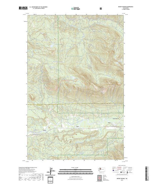
2023 Map of Mount Higgins
USGS Topo · Published 2023About this map
The North Fork Stillaguamish River corridor serves as the primary artery for settlement in this portion of the Mount Baker National Forest. Small communities like Hazel, Tulker, and Swede Heaven are concentrated along the Arlington-Darrington Rd, demonstrating how the valley floor dictated the development of this mountainous region. The transition from the river lowlands to high-altitude landmarks is abrupt, rising toward peaks such as Mt Higgins and Skadulguas Peak. Numerous remote water bodies, including Myrtle Lake and the unusually named McGillicuddys Duck-Pond, are tucked into the high ridges. This map also preserves local navigation history with labeled routes like the Mt Higgins Trl and the Segelson Pass-Snowmobile 18 Trl, alongside the border between Skagit Co and Snohomish Co.
Find a feature on this map
40 named features on this map. Tap any name to fly to it.
Don’t see what you’re looking for? This feature index may not catch every label — zoom into the map to look around manually.
Map Details
Editions of this 2023 Mount Higgins Map
This is the sole edition of this map. No revisions or reprints were ever made.
Other maps of this area

1899 · Stillaguamish
USGS Topo · 1:125,000

1901 · Stilaguamish
USGS Topo · 1:125,000

1955 · Concrete
USGS Topo · 1:250,000

1956 · Oso
USGS Topo · 1:62,500

1956 · Granite Falls
USGS Topo · 1:62,500

1957 · Silverton
USGS Topo · 1:62,500

1958 · Concrete
USGS Topo · 1:250,000

1962 · Concrete
USGS Topo · 1:250,000
1966 · Fortson
USGS Topo · 1:24,000
1966 · Finney Peak
USGS Topo · 1:24,000