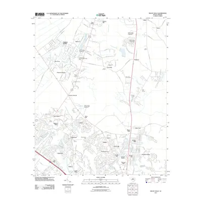
2011 Map of Mount Holly
USGS Topo · Published 2011About this map
Canterhill Swamp and the Back River define the low-lying terrain of this Berkeley County landscape, which shows a mix of historical rural settlements and modern residential expansion. The area around Mount Holly and Strawberry is characterized by a dense network of suburban developments like Chaparral Ranches and Stratford Forest, contrasting with the more scattered older communities of Wide Awake and Saint Johns. Genealogists will find a significant number of burial sites, including Groomsville Cemetery, Pear Cemetery, and the Goose Creek Cemetery. The transportation corridor is anchored by the CSX railroad and Old Highway 52, which link together smaller locales like Seaton and Oakley. Notable industrial and infrastructure landmarks, such as the Mount Holly Commerce Park and several water control structures like the South Carolina Noname 08041 Dam, underscore the region's managed landscape at the start of the 2010s.
Find a feature on this map
168 named features on this map. Tap any name to fly to it.
Don’t see what you’re looking for? This feature index may not catch every label — zoom into the map to look around manually.
Map Details
Editions of this 2011 Mount Holly Map
This is the sole edition of this map. No revisions or reprints were ever made.
Other maps of this area

1919 · Ladson
USGS Topo · 1:21,120

1919 · Summerville
USGS Topo · 1:48,000

1919 · Cordesville
USGS Topo · 1:48,000

1919 · Melgrove
USGS Topo · 1:21,120

1920 · Ravenels
USGS Topo · 1:62,500

1920 · Summerville
USGS Topo · 1:62,500

1940 · Melgrove
USGS Topo · 1:24,000

1943 · Ladson
USGS Topo · 1:24,000

1944 · Ravenels
USGS Topo · 1:62,500

1944 · Summerville
USGS Topo · 1:62,500