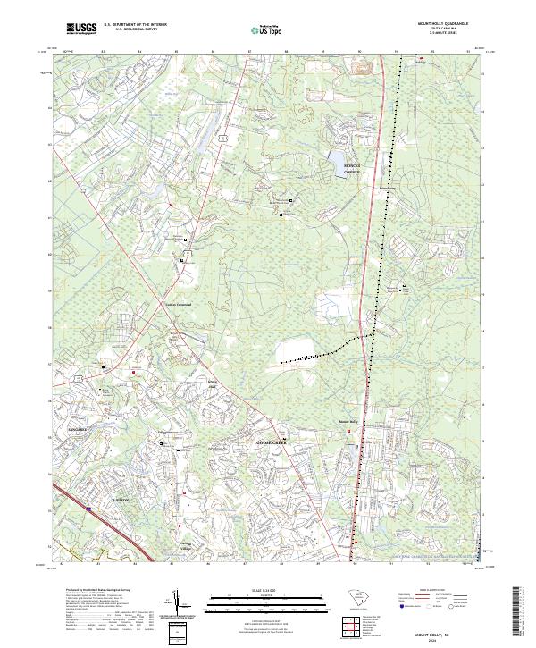
2024 Map of Mount Holly
USGS Topo · Published 2024About this map
Moncks Corner and the rapidly developing corridor of Goose Creek anchor this modern-day topographic landscape in Berkeley County. The map reveals a intricate pattern of suburban growth interlaced with the low-lying swamps of the Lowcountry, including Laurel Swamp and Canterhill Swamp. Historical continuity is preserved through numerous family and church burial grounds such as Pear Family Cem, Smyrna-Church Cem, and the Ridge Church Graveyard, which sit alongside contemporary infrastructure like the Joint Base Charleston Naval Weapons Station. The transition from old hamlets like Strawberry and Oakley to sprawling residential developments near Sangaree and Ladson illustrates the transformation of former plantation lands into a dense regional hub, while the Mount Holly Airport serves as a notable aviation landmark north of the Goose Creek center.
Find a feature on this map
297 named features on this map. Tap any name to fly to it.
Don’t see what you’re looking for? This feature index may not catch every label — zoom into the map to look around manually.
Map Details
Editions of this 2024 Mount Holly Map
This is the sole edition of this map. No revisions or reprints were ever made.
Other maps of this area

1919 · Ladson
USGS Topo · 1:21,120

1919 · Summerville
USGS Topo · 1:48,000

1919 · Cordesville
USGS Topo · 1:48,000

1919 · Melgrove
USGS Topo · 1:21,120

1920 · Ravenels
USGS Topo · 1:62,500

1920 · Summerville
USGS Topo · 1:62,500

1940 · Melgrove
USGS Topo · 1:24,000

1943 · Ladson
USGS Topo · 1:24,000

1944 · Ravenels
USGS Topo · 1:62,500

1944 · Summerville
USGS Topo · 1:62,500