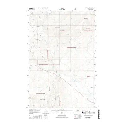
2014 Map of Mount Howe
USGS Topo · Published 2014About this map
Mt Howe rises above a landscape dominated by the protected acreage of the Lewis & Clark National Forest in Meagher County. The drainage of the N Fork Musselshell River defines the central topography, supported by a network of seasonal and perennial waters including Spring Cr and the S Fork Whetstone Cr. Human activity is marked by infrastructure like Us-12 and the Holiday Landing Strip, while the northern reaches show unique livestock management through the Cooks Elk Fence near Cooks Flat. The presence of the Mill Ditch indicates a managed water system through the river valley, serving the lower elevations between the canyons of Picnic Canyon and Long Canyon.
Find a feature on this map
31 named features on this map. Tap any name to fly to it.
Don’t see what you’re looking for? This feature index may not catch every label — zoom into the map to look around manually.
Map Details
Editions of this 2014 Mount Howe Map
This is the sole edition of this map. No revisions or reprints were ever made.
Other maps of this area

1886 · Little Belt Mts.
USGS Topo · 1:250,000

1894 · Little Belt Mts.
USGS Topo · 1:250,000

1897 · Little Belt Mts.
USGS Topo · 1:250,000

1898 · Little Belt Mts.
USGS Topo · 1:250,000

1902 · Little Belt Mts.
USGS Topo · 1:250,000

1948 · White Sulphur Springs
USGS Topo · 1:250,000

1958 · White Sulphur Springs
USGS Topo · 1:250,000

1961 · White Sulphur Springs
USGS Topo · 1:250,000

1965 · White Sulphur Springs
USGS Topo · 1:250,000
1972 · Daisy Peak
USGS Topo · 1:24,000