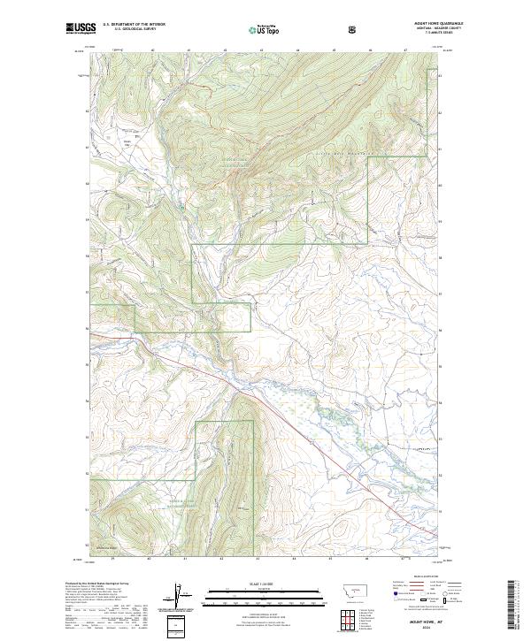
2024 Map of Mount Howe
USGS Topo · Published 2024About this map
The Little Belt Mountains dominate this section of the Lewis & Clark National Forest in Meagher County, where the high elevations of Mt Howe and Whetstone Ridge overlook a complex network of canyons and gulches. The drainage systems of the North Fork Musselshell River and Spring Creek dictate the local geography, with the Mill Ditch tracing the valley floor to manage water resources in this arid montane environment. Historical land use is evident in named landmarks like Cooks Flat and Raschke Ranch Rd, which suggest the area's legacy of high-country ranching. Modern recreation and access are facilitated by a system of primitive routes including the East Fork Spring Creek Trail and Whitehall South Trail, which navigate the steep terrain through Picnic Canyon and Cooks Gulch.
Find a feature on this map
32 named features on this map. Tap any name to fly to it.
Don’t see what you’re looking for? This feature index may not catch every label — zoom into the map to look around manually.
Map Details
Editions of this 2024 Mount Howe Map
This is the sole edition of this map. No revisions or reprints were ever made.
Other maps of this area

1886 · Little Belt Mts.
USGS Topo · 1:250,000

1894 · Little Belt Mts.
USGS Topo · 1:250,000

1897 · Little Belt Mts.
USGS Topo · 1:250,000

1898 · Little Belt Mts.
USGS Topo · 1:250,000

1902 · Little Belt Mts.
USGS Topo · 1:250,000

1948 · White Sulphur Springs
USGS Topo · 1:250,000

1958 · White Sulphur Springs
USGS Topo · 1:250,000

1961 · White Sulphur Springs
USGS Topo · 1:250,000

1965 · White Sulphur Springs
USGS Topo · 1:250,000
1972 · Daisy Peak
USGS Topo · 1:24,000