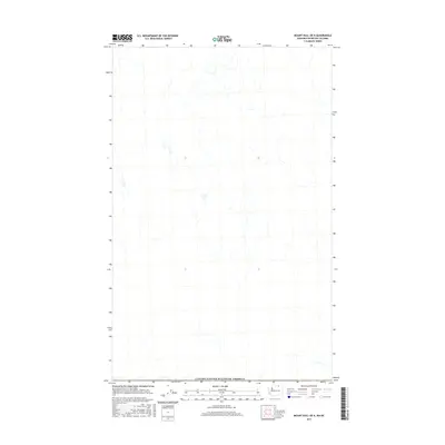
2017 Map of Mount Hull OE N
USGS Topo · Published 2017About this map
The Canada/United States of America border defines the character of this 2017 survey, representing the high-altitude terrain along the international boundary between British Columbia and Washington State. Produced by the U.S. Geological Survey using modern imagery and national datasets, the map illustrates the precise geography of this borderland area. While the landscape is sparsely labeled, the map provides a technical view of the drainage patterns and topography north of the 49th parallel. It serves as a vital record of the geopolitical boundary as it exists in the early 21st century, offering researchers a clean perspective on the undeveloped lands that straddle the line between the two nations.
Find a feature on this map
1 named feature on this map. Tap any name to fly to it.
Don’t see what you’re looking for? This feature index may not catch every label — zoom into the map to look around manually.
Map Details
Editions of this 2017 Mount Hull OE N Map
This is the sole edition of this map. No revisions or reprints were ever made.
Other maps of this area

1902 · Osoyoos
USGS Topo · 1:125,000

1904 · Osoyoos
USGS Topo · 1:125,000

1954 · Okanogan
USGS Topo · 1:250,000

1957 · Mt. Bonaparte
USGS Topo · 1:62,500

1957 · Oroville
USGS Topo · 1:62,500

1958 · Okanogan
USGS Topo · 1:250,000

1975 · Oroville NW
USGS Topo · 1:24,000

1981 · Mount Hull
USGS Topo · 1:24,000
1982 · Oroville
USGS Topo · 1:24,000

1984 · Oroville
USGS Topo · 1:100,000