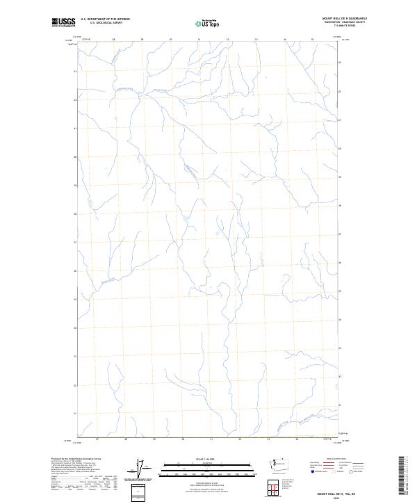
2023 Map of Mount Hull OE N
USGS Topo · Published 2023About this map
Inkaneep Creek and Coteay Creek flow through this northern section of the Okanogan highland, defining a landscape shaped by narrow drainage basins and seasonal water flow. This 2023 survey by the U.S. Geological Survey shows a sparsely developed area where natural topography dictates the few local connectors and secondary highways that cross the terrain. The presence of Gregoire Creek in the northwest and the convergence of Ninemile Creek and Nine Mile Creek in the southeast suggests a region defined by its hydrography. For those studying the rural infrastructure of Okanogan County, the map provides a clear record of current land survey systems and watercourses including Haynes Creek, reflecting the modern state of this high-elevation Washington borderland.
Find a feature on this map
6 named features on this map. Tap any name to fly to it.
Don’t see what you’re looking for? This feature index may not catch every label — zoom into the map to look around manually.
Map Details
Editions of this 2023 Mount Hull OE N Map
This is the sole edition of this map. No revisions or reprints were ever made.
Other maps of this area

1902 · Osoyoos
USGS Topo · 1:125,000

1904 · Osoyoos
USGS Topo · 1:125,000

1954 · Okanogan
USGS Topo · 1:250,000

1957 · Mt. Bonaparte
USGS Topo · 1:62,500

1957 · Oroville
USGS Topo · 1:62,500

1958 · Okanogan
USGS Topo · 1:250,000

1975 · Oroville NW
USGS Topo · 1:24,000

1981 · Mount Hull
USGS Topo · 1:24,000
1982 · Oroville
USGS Topo · 1:24,000

1984 · Oroville
USGS Topo · 1:100,000