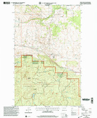
2001 Map of Mount Hull
USGS Topo · Published 2004About this map
Okanogan National Forest dominates the southern half of this landscape, where high elevations like Mount Hull and McDonald Mountain overlook the international border between Canada and the United States. The topography is defined by significant vertical relief and the drainage patterns of Ninemile Creek and Tonasket Creek. Evidence of early 20th-century land management is visible through the Indian Boundary and various allotment boundaries that crisscross the northern sections.
Find a feature on this map
23 named features on this map. Tap any name to fly to it.
Don’t see what you’re looking for? This feature index may not catch every label — zoom into the map to look around manually.
Map Details
Editions of this 2001 Mount Hull Map
This is the sole edition of this map. No revisions or reprints were ever made.
Other maps of this area

1902 · Osoyoos
USGS Topo · 1:125,000

1904 · Osoyoos
USGS Topo · 1:125,000

1954 · Okanogan
USGS Topo · 1:250,000

1957 · Mt. Bonaparte
USGS Topo · 1:62,500

1957 · Oroville
USGS Topo · 1:62,500

1958 · Okanogan
USGS Topo · 1:250,000

1975 · Oroville NW
USGS Topo · 1:24,000
1981 · Burge Mtn
USGS Topo · 1:24,000

1981 · Mount Hull
USGS Topo · 1:24,000
1982 · Ellisforde
USGS Topo · 1:24,000