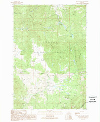
1989 Map of Mount Humbug
USGS Topo · Published 1989About this map
The Continental Divide snakes through this high-elevation terrain in Silver Bow and Madison Counties, marking a landscape defined by its mining legacy and water management. Numerous locations labeled Prospect and Prospects, along with an Open Pit Mine and a Mine Shaft, indicate the persistent search for mineral wealth throughout the gulches and ridges. The settlement of Moose Town sits near the headwaters of Moose Creek, serving as a focal point for the surrounding network of mountain drainages.
Find a feature on this map
28 named features on this map. Tap any name to fly to it.
Don’t see what you’re looking for? This feature index may not catch every label — zoom into the map to look around manually.
Map Details
Editions of this 1989 Mount Humbug Map
This is the sole edition of this map. No revisions or reprints were ever made.
Other maps of this area

1893 · Dillon
USGS Topo · 1:250,000

1955 · Dillon
USGS Topo · 1:250,000

1957 · Dillon
USGS Topo · 1:250,000

1958 · Dillon
USGS Topo · 1:250,000

1960 · Twin Bridges
USGS Topo · 1:62,500

1961 · Melrose
USGS Topo · 1:24,000

1961 · Wickiup Creek
USGS Topo · 1:24,000

1961 · Butte South
USGS Topo · 1:62,500

1962 · Dillon
USGS Topo · 1:250,000

1963 · Pipestone Pass
USGS Topo · 1:24,000