
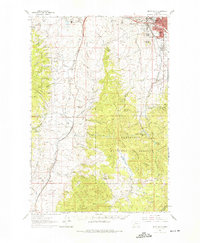
1961 Map of Butte South
USGS Topo · Published 1964About this map
Industrial and urban expansion defines the landscape south of Butte in the early 1960s. The city's southern edge is marked by a concentration of local history markers, including several large burial grounds such as Mt Moriah Cem, St Patrick Cem, and Mountain View Cem. South of the urban core, the map reveals a critical transportation hub where the Union Pacific and the Chicago Milwaukee St Paul and Pacific railroads converge near Buxton Siding.
Find a feature on this map
96 named features on this map. Tap any name to fly to it.
Don’t see what you’re looking for? This feature index may not catch every label — zoom into the map to look around manually.
Map Details
Editions of this 1961 Butte South Map
2 editions found
Other maps of this area

1889 · Helena
USGS Topo · 1:250,000

1893 · Helena
USGS Topo · 1:250,000

1893 · Dillon
USGS Topo · 1:250,000

1899 · Boulder
USGS Topo · 1:125,000

1899 · Helena
USGS Topo · 1:250,000

1903 · Helena
USGS Topo · 1:250,000

1947 · Butte
USGS Topo · 1:250,000

1954 · Elk Park
USGS Topo · 1:62,500

1955 · Dillon
USGS Topo · 1:250,000

1957 · Dillon
USGS Topo · 1:250,000