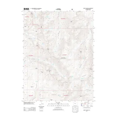
2013 Map of Mount Jackson
USGS Topo · Published 2013About this map
Mount Jackson dominates this high-altitude landscape within the White River National Forest, surrounded by a dense network of glacial basins and alpine lakes. The terrain is characterized by dramatic elevation changes, where peaks like Savage Peak and Gold Dust Peak tower over drainages such as East Lake Creek and Cross Creek. A series of historic trails, including the Lake Charles Trail and the East Lake Creek Trail, provide the primary access to remote water bodies like Mystic Island Lake and Lake Charles. Evidence of early 20th-century exploration and naming is seen in features like Negro Basin, Slim Jim Gulch, and Fools Peak. The southeastern corner is particularly intricate, featuring the Missouri Lakes and Treasure Vault Lake tucked beneath the Holy Cross Ridge, illustrating the complex hydrology of the Continental Divide region. This survey captures a wild area defined by its lack of roads, emphasizing the importance of the historic trail system for navigating the high peaks and passes like Missouri Pass.
Find a feature on this map
61 named features on this map. Tap any name to fly to it.
Don’t see what you’re looking for? This feature index may not catch every label — zoom into the map to look around manually.
Map Details
Editions of this 2013 Mount Jackson Map
This is the sole edition of this map. No revisions or reprints were ever made.
Other maps of this area

1889 · Leadville
USGS Topo · 1:125,000

1891 · Leadville
USGS Topo · 1:125,000

1909 · Mount Jackson
USGS Topo · 1:125,000

1911 · Mount Jackson
USGS Topo · 1:125,000

1934 · Minturn
USGS Topo · 1:62,500

1942 · Leadville
USGS Topo · 1:125,000

1949 · Holy Cross
USGS Topo · 1:62,500

1950 · Minturn
USGS Topo · 1:62,500

1951 · Holy Cross
USGS Topo · 1:62,500

1957 · Leadville
USGS Topo · 1:250,000