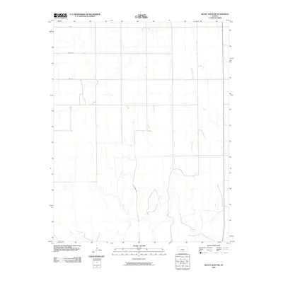
2009 Map of Mount Jesus NW
USGS Topo · Published 2009About this map
Mt Jesus Rd cuts through the rural landscape of Ford County, defining a territory where the High Plains transition into a network of intermittent drainage systems. This 2009 survey by the U.S. Geological Survey illustrates a sparse settlement pattern dominated by agricultural section lines and seasonal waterways. The drainage network is particularly detailed, showing the northern reaches of Fish Creek and Cat Creek as they meander through the southern half of the quadrangle, while Rattlesnake Creek and West Kiowa Creek drain the northern and eastern reaches. The rectilinear road grid, including alphanumeric designations like X Rd and Yucca Rd, reflects the systematic land division typical of western Kansas. The lack of concentrated townsites emphasizes the area's open ranching and farming character at the turn of the 21st century.
Find a feature on this map
9 named features on this map. Tap any name to fly to it.
Don’t see what you’re looking for? This feature index may not catch every label — zoom into the map to look around manually.
Map Details
Editions of this 2009 Mount Jesus NW Map
This is the sole edition of this map. No revisions or reprints were ever made.
Other maps of this area

1892 · Spearville
USGS Topo · 1:125,000

1894 · Spearville
USGS Topo · 1:125,000

1896 · Ashland
USGS Topo · 1:125,000

1955 · Pratt
USGS Topo · 1:250,000

1959 · Pratt
USGS Topo · 1:250,000

1969 · Bucklin SE
USGS Topo · 1:24,000

1969 · Bucklin
USGS Topo · 1:24,000

1969 · Kingsdown
USGS Topo · 1:24,000

1979 · Bloom SE
USGS Topo · 1:24,000

1979 · Turkey Creek
USGS Topo · 1:24,000