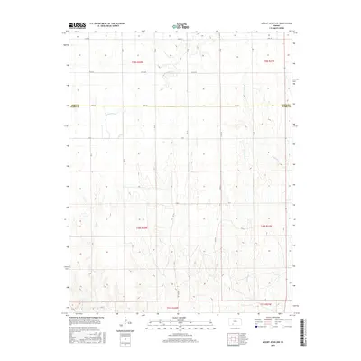
2015 Map of Mount Jesus NW
USGS Topo · Published 2015About this map
The High Plains landscape of the Kansas borderlands is defined by a grid of rural section lines and the dendritic drainage of several small waterways. The northern half of the area is situated in Ford County, while the southern portion transitions into Clark County, with the boundary crossing near Zane Rd. This 2015 survey shows a terrain carved by several creek systems, including Rattlesnake Cr in the northwest and W Kiowa Cr in the northeast. The southern landscape is more deeply dissected, as evidenced by the winding courses of Fish Cr and Cat Cr. Settlement patterns remain sparse and strictly agricultural, anchored by long unpaved thoroughfares such as Lane Rd, Yucca Rd, and Mt Jesus Rd. The map illustrates the persistent 19th-century Public Land Survey System, showing several townships like t30s r22w and t29s r21w that have organized this prairie region for generations.
Find a feature on this map
22 named features on this map. Tap any name to fly to it.
Don’t see what you’re looking for? This feature index may not catch every label — zoom into the map to look around manually.
Map Details
Editions of this 2015 Mount Jesus NW Map
This is the sole edition of this map. No revisions or reprints were ever made.
Other maps of this area

1892 · Spearville
USGS Topo · 1:125,000

1894 · Spearville
USGS Topo · 1:125,000

1896 · Ashland
USGS Topo · 1:125,000

1955 · Pratt
USGS Topo · 1:250,000

1959 · Pratt
USGS Topo · 1:250,000

1969 · Bucklin SE
USGS Topo · 1:24,000

1969 · Bucklin
USGS Topo · 1:24,000

1969 · Kingsdown
USGS Topo · 1:24,000

1979 · Bloom SE
USGS Topo · 1:24,000

1979 · Turkey Creek
USGS Topo · 1:24,000