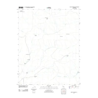
2012 Map of Mount Johnson
USGS Topo · Published 2012About this map
The Gabilan Range dominates this portion of Monterey County, defining a landscape of deep canyons and seasonal watercourses. The prominent summit of Mount Johnson stands as a primary landmark, overlooking a network of drainages such as McCoy Cr and Willow Cr. The map reveals a rugged topography characterized by numerous named canyons, including Ben Graves Canyon, Sullivan Canyon, and the remote Shady Lane Canyon. These features illustrate the complex geological erosion of the range and the distribution of natural resources in this part of California.
Find a feature on this map
25 named features on this map. Tap any name to fly to it.
Don’t see what you’re looking for? This feature index may not catch every label — zoom into the map to look around manually.
Map Details
Editions of this 2012 Mount Johnson Map
This is the sole edition of this map. No revisions or reprints were ever made.
Other maps of this area

1910 · Gonzales
USGS Topo · 1:31,680

1910 · Soledad
USGS Topo · 1:31,680

1915 · Soledad
USGS Topo · 1:62,500

1919 · San Benito
USGS Topo · 1:62,500

1921 · Gonzales
USGS Topo · 1:62,500

1921 · Metz
USGS Topo · 1:62,500

1931 · San Benito
USGS Topo · 1:62,500

1940 · Metz
USGS Topo · 1:62,500

1940 · Soledad
USGS Topo · 1:62,500

1940 · San Benito
USGS Topo · 1:62,500