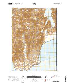
2019 Map of Mount Katmai A-3 SE
USGS Topo · Published 2019About this map
Katmai National Park encompasses the majority of this coastal landscape on the Alaska Peninsula, where the mountainous terrain meets the Pacific Ocean. This high-elevation topography is defined by prominent peaks like Mt Pedmar, which stands as a significant landmark in the southwestern portion of the map. The drainage patterns in this protected wilderness are characterized by short, steep runs from the summits down to the tidal waters of Dakavak Bay.
Find a feature on this map
9 named features on this map. Tap any name to fly to it.
Don’t see what you’re looking for? This feature index may not catch every label — zoom into the map to look around manually.
Map Details
Editions of this 2019 Mount Katmai A-3 SE Map
This is the sole edition of this map. No revisions or reprints were ever made.
Other maps of this area

1948 · Mt Katmai
USGS Topo · 1:250,000

1951 · Mt Katmai
USGS Topo · 1:250,000

1951 · Karluk
USGS Topo · 1:250,000

1951 · Mount Katmai A-3
USGS Topo · 1:63,360

1951 · Mount Katmai A-2
USGS Topo · 1:63,360

1952 · Karluk
USGS Topo · 1:250,000

1964 · Mt. Katmai
USGS Topo · 1:250,000

1964 · Karluk
USGS Topo · 1:250,000
2019 · Mount Katmai A-3 NE
USGS Topo · 1:25,000
2019 · Mount Katmai A-2 SW
USGS Topo · 1:25,000