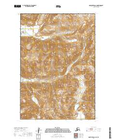
2019 Map of Mount Katmai A-3 NE
USGS Topo · Published 2019About this map
Katmai National Park encompasses this high-elevation Alaskan wilderness, where the Katmai River flows through a landscape defined by the towering Barrier Range. This 2019 survey captures the hydrological and geological character of a region where the Soluka Cr drainage system intersects with steep mountain passes. The absence of roads or established settlements emphasizes the preservation of the native terrain, which includes Noisy Mtn to the northwest and the strategically named Hagelbargers Pass on the eastern boundary. Researchers and surveyors can trace the precise topographic contours of the Katmai Lakes and the surrounding glacial valleys, which illustrate the raw physical geography of the Lake and Peninsula Borough before modern development or climate-driven changes significantly altered the permafrost and water levels of the subarctic interior.
Find a feature on this map
13 named features on this map. Tap any name to fly to it.
Don’t see what you’re looking for? This feature index may not catch every label — zoom into the map to look around manually.
Map Details
Editions of this 2019 Mount Katmai A-3 NE Map
This is the sole edition of this map. No revisions or reprints were ever made.
Other maps of this area

1948 · Mt Katmai
USGS Topo · 1:250,000

1951 · Mt Katmai
USGS Topo · 1:250,000

1951 · Mount Katmai A-3
USGS Topo · 1:63,360

1951 · Mount Katmai A-2
USGS Topo · 1:63,360

1951 · Mount Katmai B-3
USGS Topo · 1:63,360

1951 · Mount Katmai B-2
USGS Topo · 1:63,360

1964 · Mt. Katmai
USGS Topo · 1:250,000
2019 · Mount Katmai B-3 SE
USGS Topo · 1:25,000
2019 · Mount Katmai A-2 SW
USGS Topo · 1:25,000
2019 · Mount Katmai A-3 SE
USGS Topo · 1:25,000