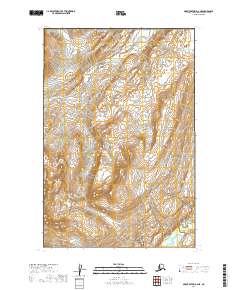
2019 Map of Mount Katmai D-2 NE
USGS Topo · Published 2019About this map
Katmai National Park encompasses the majority of this landscape, showcasing a remote wilderness defined by dramatic topographic relief and glacial drainage patterns. The Little Kamishak River flows through the northern reaches, carving a path between the high ridges of the Alaska Peninsula. To the south, Strike Creek marks the lower elevations of the quadrangle. This 2019 survey provides a precise view of the terrain within the Katmai National Park boundaries, illustrating the complex network of ridges and valleys that characterize this protected region. The lack of human infrastructure or established roads highlights the preserve's role as a vast, undeveloped ecosystem where natural geomorphology remains the dominant feature.
Find a feature on this map
7 named features on this map. Tap any name to fly to it.
Don’t see what you’re looking for? This feature index may not catch every label — zoom into the map to look around manually.
Map Details
Editions of this 2019 Mount Katmai D-2 NE Map
This is the sole edition of this map. No revisions or reprints were ever made.
Other maps of this area

1948 · Mt Katmai
USGS Topo · 1:250,000

1951 · Mt Katmai
USGS Topo · 1:250,000

1951 · Iliamna A-5
USGS Topo · 1:63,360

1951 · Iliamna A-4
USGS Topo · 1:63,360

1951 · Mount Katmai D-1
USGS Topo · 1:63,360

1951 · Mount Katmai D-2
USGS Topo · 1:63,360

1952 · Iliamna
USGS Topo · 1:250,000

1952 · Iliamna A-4
USGS Topo · 1:63,360

1952 · Iliamna A-5
USGS Topo · 1:63,360
1953 · Mount Katmai D-1
USGS Topo · 1:63,360