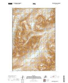
2019 Map of Mount Katmai D-2 NW
USGS Topo · Published 2019About this map
The wild, unpopulated terrain of the Katmai National Park interior is the focus of this 2019 survey. The landscape is defined by its significant hydrography, specifically the headwaters and drainages of the McNeil River in the northwest and the Little Kamishak River as it winds through the south-central portion of the quadrangle. This area of the Kenai Peninsula is part of a massive protected wilderness, showing no modern road infrastructure or named settlements. Instead, the map provides a precise record of the natural topography and the legal boundaries of the Katmai National Park, serving as a foundational document for understanding the drainage patterns of this remote coastal region of Alaska.
Find a feature on this map
7 named features on this map. Tap any name to fly to it.
Don’t see what you’re looking for? This feature index may not catch every label — zoom into the map to look around manually.
Map Details
Editions of this 2019 Mount Katmai D-2 NW Map
This is the sole edition of this map. No revisions or reprints were ever made.
Other maps of this area

1948 · Mt Katmai
USGS Topo · 1:250,000

1951 · Mt Katmai
USGS Topo · 1:250,000

1951 · Iliamna A-5
USGS Topo · 1:63,360

1951 · Iliamna A-4
USGS Topo · 1:63,360

1951 · Mount Katmai D-2
USGS Topo · 1:63,360

1951 · Mount Katmai D-3
USGS Topo · 1:63,360

1952 · Iliamna
USGS Topo · 1:250,000

1952 · Iliamna A-4
USGS Topo · 1:63,360

1952 · Iliamna A-5
USGS Topo · 1:63,360

1957 · Iliamna
USGS Topo · 1:250,000