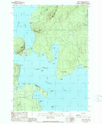
1989 Map of Mount Kineo
USGS Topo · Published 1989About this map
Mount Kineo dominates this 1989 topographic study of central Moosehead Lake, rising sharply from the eastern shore across from the settlement of Rockwood. The landscape is defined by vast historic land grants and tracts, including the Days Academy Grant and the East Middlesex Canal Grant, which indicate early Maine land speculation and development patterns. The shoreline of the lake is heavily articulated by numerous coves such as Kineo Cove, Harris Cove, and Cowan Cove, along with a series of islands including Boulder Island and Sand Bar Island. To the north, the terrain transitions toward Little Kineo Mtn and Shaw Mountain, while the southern portion of the sheet reveals the complex topography of the Sand Bar Tract and the Taunton and Raynham territory. The isolated Deer Head Farm sits on a point, providing a rare glimpse into small-scale agricultural settlement within this forested region.
Find a feature on this map
40 named features on this map. Tap any name to fly to it.
Don’t see what you’re looking for? This feature index may not catch every label — zoom into the map to look around manually.
Map Details
Editions of this 1989 Mount Kineo Map
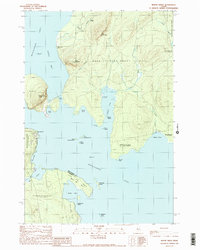
2 editions found
Other maps of this area

1920 · Moosehead Lake
USGS Topo · 1:62,500

1921 · Brassua Lake
USGS Topo · 1:62,500

1922 · Moosehead Lake
USGS Topo · 1:62,500

1923 · Brassua Lake
USGS Topo · 1:62,500

1930 · Moosehead Lake
USGS Topo · 1:62,500

1944 · Brassua Lake
USGS Topo · 1:62,500

1944 · Moosehead Lake
USGS Topo · 1:62,500

1954 · Seboomook Lake
USGS Topo · 1:62,500

1954 · North East Carry
USGS Topo · 1:62,500

1954 · Millinocket
USGS Topo · 1:250,000
Featured Places
- Misery Gore, ME
- Days Academy Grant Township, ME
- Spencer Bay Township, ME
- Sandbar Tract Township, ME
- Kineo Township, ME