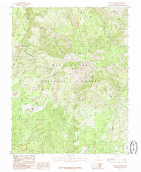
1985 Map of Mount Linnaeus
USGS Topo · Published 1985About this map
The Manti-La Sal National Forest dominates this mid-1980s topographical survey, centered on the high elevations of the Abajo Mountains in San Juan County. The terrain is defined by dramatic vertical relief, from the summit of Mount Linnaeus to the deep incisions of Allen Canyon and Tuerto Canyon. A specialized network of water management and livestock support is evident in the placement of the Gaging Station and various water sources like Jack Spring and Bayles Spring. Notable landmarks such as The Causeway and the evocatively named Skull and Crossbones indicate a landscape where travel was dictated by sharp ridges and steep canyon walls. This survey captures the wilderness character of the region before modern digital mapping, preserving the locations of high-altitude features like Robertson Pasture and Aspen Flat used for seasonal grazing and forest management.
Find a feature on this map
32 named features on this map. Tap any name to fly to it.
Don’t see what you’re looking for? This feature index may not catch every label — zoom into the map to look around manually.
Map Details
Editions of this 1985 Mount Linnaeus Map
2 editions found
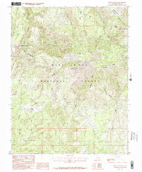
Other maps of this area

1886 · Abajo
USGS Topo · 1:250,000

1892 · Abajo
USGS Topo · 1:250,000

1893 · Abajo
USGS Topo · 1:250,000

1935 · Elk Ridge
USGS Topo · 1:96,000

1940 · Elk Ridge
USGS Topo · 1:125,000

1954 · Elk Ridge 4 NW
USGS Topo · 1:24,000

1954 · Elk Ridge 1 SW
USGS Topo · 1:24,000

1954 · Elk Ridge 1 NW
USGS Topo · 1:24,000

1954 · Elk Ridge 1 NE
USGS Topo · 1:24,000

1954 · Elk Ridge 1 SE
USGS Topo · 1:24,000