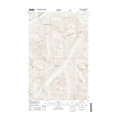
2014 Map of Mount Lyall
USGS Topo · Published 2014About this map
North Cascades National Park and Wenatchee National Forest converge in this high-altitude landscape dominated by steep ridges and glacial remnants. The Pacific Crest National Scenic Trail winds through the northwestern corner, descending toward the deep incision of Agnes Gorge. To the east, the Stehekin Valley Rd follows the course of the Stehekin River, providing a narrow corridor of human access into this wilderness. Significant peaks define the horizon, from Mount Lyall in the southwest to the sharp elevations of Tupshin Peak and Devore Peak in the east. The drainage pattern is complex, with numerous creeks like Company Cr and Agnes Cr fueled by high-elevation sources such as the Company Glacier. This survey captures the topographical intensity of the Cascades, where Heather Ridge and Sisi Ridge separate narrow valleys and remote alpine catchments like Marie Lake.
Find a feature on this map
33 named features on this map. Tap any name to fly to it.
Don’t see what you’re looking for? This feature index may not catch every label — zoom into the map to look around manually.
Map Details
Editions of this 2014 Mount Lyall Map
This is the sole edition of this map. No revisions or reprints were ever made.
Other maps of this area

1902 · Stehekin
USGS Topo · 1:125,000

1904 · Stehekin
USGS Topo · 1:125,000

1944 · Holden
USGS Topo · 1:62,500

1944 · Lucerne
USGS Topo · 1:62,500

1949 · Lucerne
USGS Topo · 1:62,500

1949 · Holden
USGS Topo · 1:62,500

1955 · Concrete
USGS Topo · 1:250,000

1958 · Concrete
USGS Topo · 1:250,000

1962 · Concrete
USGS Topo · 1:250,000

1963 · Mc Gregor Mtn
USGS Topo · 1:24,000