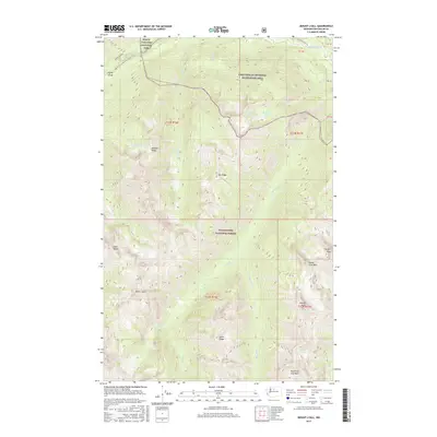
2017 Map of Mount Lyall
USGS Topo · Published 2017About this map
Mount Lyall rises as a central landmark within this high-elevation wilderness where the borders of three major federal jurisdictions meet. The terrain is defined by sharp ridges and deep drainages, with the North Cascades National Park occupying the northern reach, while the Wenatchee National Forest and Lake Chelan National Recreation Area cover the remaining landscape. The Pacific Crest National Scenic Trail winds through the northwestern corner, descending toward the Agnes Gorge. To the northeast, the Stehekin River corridor provides a rare point of access via the Stehekin Valley Rd, serving as a vital artery in an otherwise roadless expanse of peaks like Devore Peak and Tupshin Peak. Numerous alpine features, including Battalion Lake and the Fourth of July Basin, illustrate the complex glacial topography that characterizes this portion of Chelan County.
Find a feature on this map
30 named features on this map. Tap any name to fly to it.
Don’t see what you’re looking for? This feature index may not catch every label — zoom into the map to look around manually.
Map Details
Editions of this 2017 Mount Lyall Map
This is the sole edition of this map. No revisions or reprints were ever made.
Other maps of this area

1902 · Stehekin
USGS Topo · 1:125,000

1904 · Stehekin
USGS Topo · 1:125,000

1944 · Holden
USGS Topo · 1:62,500

1944 · Lucerne
USGS Topo · 1:62,500

1949 · Lucerne
USGS Topo · 1:62,500

1949 · Holden
USGS Topo · 1:62,500

1955 · Concrete
USGS Topo · 1:250,000

1958 · Concrete
USGS Topo · 1:250,000

1962 · Concrete
USGS Topo · 1:250,000

1963 · Mc Gregor Mtn
USGS Topo · 1:24,000