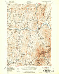
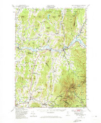
1948 Map of Mount Mansfield
USGS Topo · Published 1954About this map
Mt Mansfield State Forest dominates the southeastern quadrant of this post-war landscape, where high-altitude landmarks like the Mt Mansfield Hotel and Taft Lodge mark the rugged heights of the Green Mountains. The mountain's ridge is traced by the Long Trail, while the valleys below reveal a deeply rooted settlement pattern of ethnic enclaves such as the Irish Settlement and English Settlement, each once served by its own schoolhouses like the Irish Settlement Sch. Along the Lamoille River, the St Johnsbury and Lamoille Co RR connects the riverside villages of Cambridge and Jeffersonville. Small-scale industry is evidenced by the Morse Mill and a Sawmill near North Underhill, while local education and faith are represented by numerous rural schools and the Meth Ch in Cambridge. This survey captures the transition from a traditional agrarian and timber economy toward the burgeoning ski industry at Madonna Peak.
Find a feature on this map
145 named features on this map. Tap any name to fly to it.
Don’t see what you’re looking for? This feature index may not catch every label — zoom into the map to look around manually.
Map Details
Editions of this 1948 Mount Mansfield Map
5 editions found
Other maps of this area

1906 · Burlington
USGS Topo · 1:62,500

1913 · Milton
USGS Topo · 1:48,000

1914 · St. Albans
USGS Topo · 1:48,000

1915 · Milton
USGS Topo · 1:62,500

1916 · St. Albans
USGS Topo · 1:62,500

1919 · Burlington
USGS Topo · 1:62,500

1919 · Montgomery
USGS Topo · 1:62,500

1919 · Montpelier
USGS Topo · 1:62,500

1920 · Franklin Pond
USGS Topo · 1:62,500

1920 · Montgomery
USGS Topo · 1:62,500