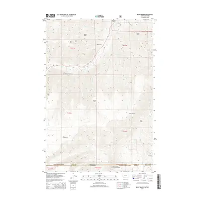
2014 Map of Mount Maurice
USGS Topo · Published 2014About this map
Mount Maurice and the high alpine terrain of the Beartooth Front dominate this landscape along the border of Montana and Wyoming. The map provides a detailed view of the transition from the steep drainages of the Custer National Forest in the north to the Shoshone National Forest in the south. High-elevation features like the Line Creek Plateau and Wapiti Mtn define the western portion of the quadrangle, while the eastern slopes drop into deep erosional features such as Robertson Draw and Mill Draw. The presence of Us-212 winding through the canyon of Rock Creek represents the primary corridor through this wilderness. Numerous seasonal and perennial drainages, including Maurice Creek and Seeley Creek, carve through named gulches like Hakel Gulch and Woods Gulch, illustrating the complex water-carved topography of the region.
Find a feature on this map
37 named features on this map. Tap any name to fly to it.
Don’t see what you’re looking for? This feature index may not catch every label — zoom into the map to look around manually.
Map Details
Editions of this 2014 Mount Maurice Map
This is the sole edition of this map. No revisions or reprints were ever made.
Other maps of this area

1944 · Red Lodge
USGS Topo · 1:62,500

1950 · Clark
USGS Topo · 1:62,500

1950 · Deep Lake
USGS Topo · 1:62,500

1954 · Billings
USGS Topo · 1:250,000

1955 · Cody
USGS Topo · 1:250,000

1956 · Mount Maurice
USGS Topo · 1:62,500

1957 · Billings
USGS Topo · 1:250,000

1958 · Billings
USGS Topo · 1:250,000

1958 · Cody
USGS Topo · 1:250,000

1962 · Cody
USGS Topo · 1:250,000