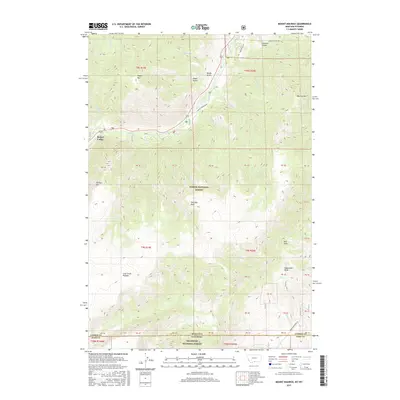
2017 Map of Mount Maurice
USGS Topo · Published 2017About this map
Richel Lodge sits at the northern edge of this high-altitude landscape where the Beartooth Mountains meet the state line. The topography is dominated by the massive Line Creek Plateau, which spans the boundary between the Custer National Forest in Montana and the Shoshone National Forest in Wyoming. Drainage patterns are sharply defined by steep canyons and gulches, including Hakel Gulch and Woods Gulch, which feed into the primary arterial flow of Rock Cr.
Find a feature on this map
35 named features on this map. Tap any name to fly to it.
Don’t see what you’re looking for? This feature index may not catch every label — zoom into the map to look around manually.
Map Details
Editions of this 2017 Mount Maurice Map
This is the sole edition of this map. No revisions or reprints were ever made.
Other maps of this area

1944 · Red Lodge
USGS Topo · 1:62,500

1950 · Clark
USGS Topo · 1:62,500

1950 · Deep Lake
USGS Topo · 1:62,500

1954 · Billings
USGS Topo · 1:250,000

1955 · Cody
USGS Topo · 1:250,000

1956 · Mount Maurice
USGS Topo · 1:62,500

1957 · Billings
USGS Topo · 1:250,000

1958 · Billings
USGS Topo · 1:250,000

1958 · Cody
USGS Topo · 1:250,000

1962 · Cody
USGS Topo · 1:250,000